Boating Safety: Check The Weather Before Every Outing
It can’t be emphasised enough how important it is to check a marine weather forecast as part of your trip preparation- January 28, 2017
- Uncategorized
- Posted by Get That Boat Loan
- Comments Off on Boating Safety: Check The Weather Before Every Outing
With the boating season well and truly underway, and hopefully the best boating conditions for the season still to come we though it was would be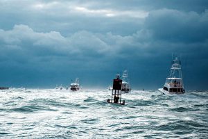 timely to remind you how important it is to check the weather before heading out for a day on the water.
It can’t be emphasised enough how important it is to check a marine weather forecast as part of your trip preparation, no matter what time of year, how far from the shore you’ll venture, or how long you intend to stay out.
The breeze can change quite dramatically, especially in the summer, when a strong afternoon sea breeze can change conditions dramatically.
Here are our top ten weather watch pointers to look out for when you go boating:
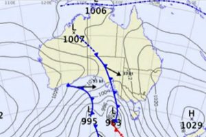
- In the southern hemisphere, air circulates clockwise around low pressure systems and anticlockwise around high pressure systems – it’s the other way around in the northern hemisphere. The lines on a weather map indicate areas of equal pressure. The closer together the lines, the stronger the wind will be.
- Weather fronts are boundaries between high and low pressure systems. Where there is a significant difference between the air masses, such as in temperature or moisture, fronts can cause strong winds, squalls, and rough seas. The different direction in air rotation between highs and lows causes the wind to shift direction suddenly and can result in confused, steep seas.
- Our weather comes from the west and moves to the east. In southern states, westerly and south westerly winds have been dragged over the ocean and can be cold and moist. In northern areas, air coming from over the sea is moist and may be warmer, while air coming from over the land will be dry.
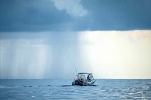
- Check a marine weather forecast for predicted wave heights, keeping in mind that waves may intermittently be up to twice the predicted height. Waves are mostly caused by wind – generally, the stronger the wind and the greater the fetch (the length of water over which wind has blown), the larger the waves.
- Local and underwater topography will affect the wind and waves. Wind can speed up when squeezed between valleys, while waves can be short and steep in confined waterways such as bays, inland lakes or areas with many small islands. Waves hitting the shoreline bounce back, steepening and confusing seas.
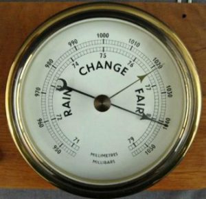
- A barometer can indicate the approach of a cold front (the air pressure will fall). If the pressure drops rapidly, the change will be stronger than if it falls gradually.
- Read the clouds for signs of changing weather. Take note if clouds are increasing or decreasing and watch the sequence of cloud formation – for example, high-level feathery clouds are often a precursor to a weather change. If they thicken and join up while becoming lower, change is on the way. Look out for cauliflower-type clouds (cumulus or cumulonimbus clouds) building up to a high altitude, often with an anvil-shaped top. When thunderstorms are forecast or you spot these clouds, head for shelter.
- Cyclones are intense low-pressure systems that start when warm moist air and cold air collide. Fully developed cyclones have a centre of low pressure and extremely high winds. If you are on the water when a cyclone warning is issued, make for a safe port.
- Air warming up over land rises and cooler air over the water moves to take its place, resulting in sea or onshore breezes. These can be quite strong and can quickly develop waves — WA’s Fremantle Doctor is an example. In tropical areas, the reverse can happen at night, causing offshore or land breezes.
- Fog can create navigational problems. Advection fog (when warm, moist air is drawn across water) can occur any time. Radiation fog (when the moisture dew-point corresponds with the air temperature) is found in Australia’s southern half, mainly during autumn and winter.
One of the best, and easiest, ways to check your local weather and receive severe weather alerts is via the Club Marine App which can be downloaded on the Apple Apps Store or Google Play. For marine weather forecasts you can also go to Bureau of Meteorology’s website or MetEye, BOM’s interactive forecast tool.
On the water, keep a lookout, be aware of changes in conditions, and listen for updates and weather warnings on the radio.
And remember: if in doubt, don’t go out.